A Plan of the Umayyad Palaces West of the al-Aqsa Mosque
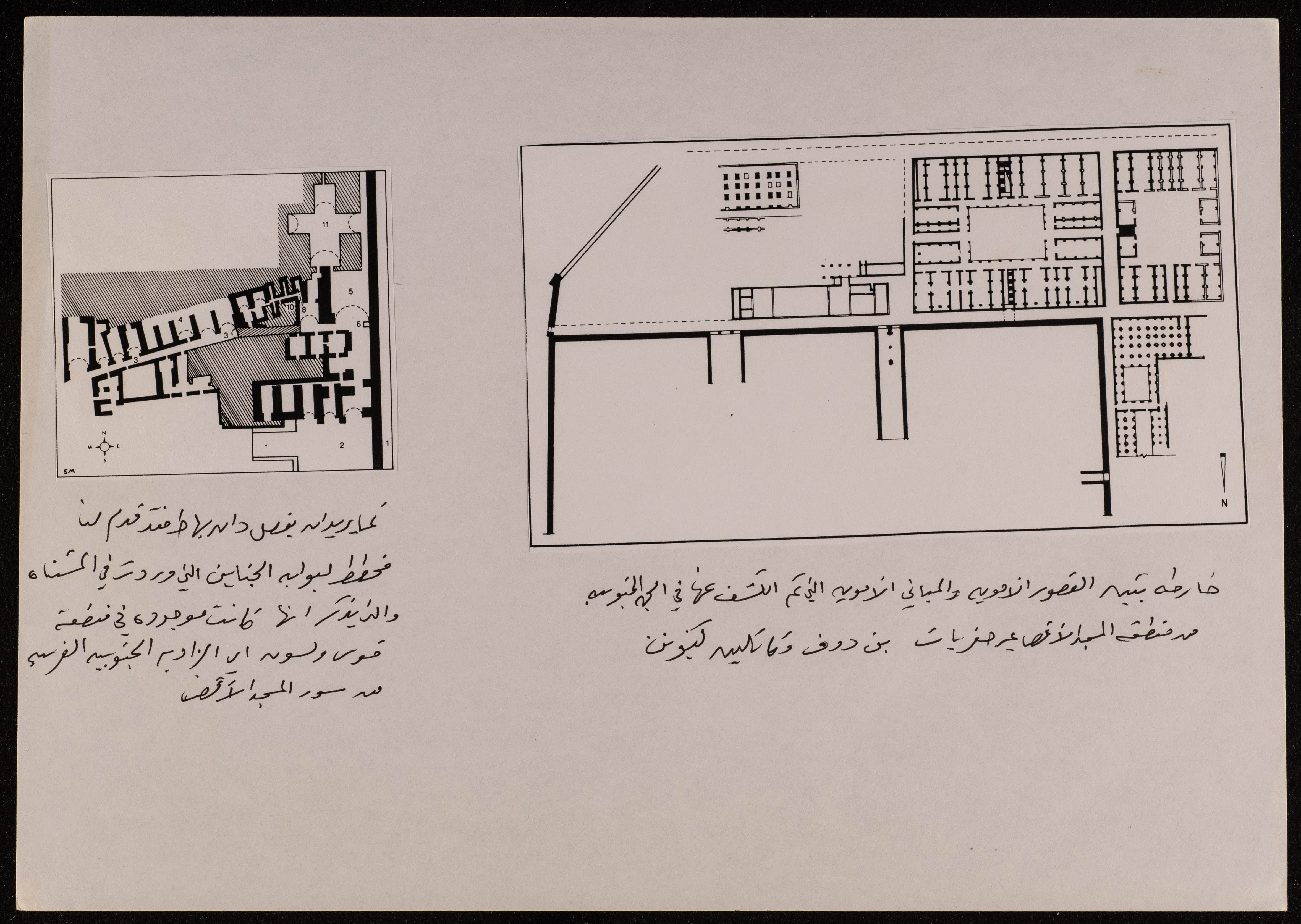
Found in Palestinian archaeologist Ibrahim al-Fanny's collection, this document consists of a map showing Umayyad palaces and buildings discovered to the south of al-Aqsa Mosque Area through the excavations of Kathleen Kenyon and Meir bin Dov, as well as a plan made by Dan for the Gardens Gate which was located in the Wilson's Arch area, which is the southwest part of al-Aqsa Mosque wall. Undated.
Date created
Tags
Topics
TYPE
LOCATION
More details
Format
Records (Documents) Color photographs
Source of Description
Jubeh, Baha (Palestinian Museum Registrar), recorded interview with PMDA researcher Samar Ozrail, 24 March 2021, the Palestinian Museum Digital Archive.
Physical status
medium
Help us refine the information, suggest a change in the content of this item
Suggest a ChangeA Plan of the Umayyad Palaces West of the al-Aqsa Mosque
This photo may contain violent content