0294.01.0369
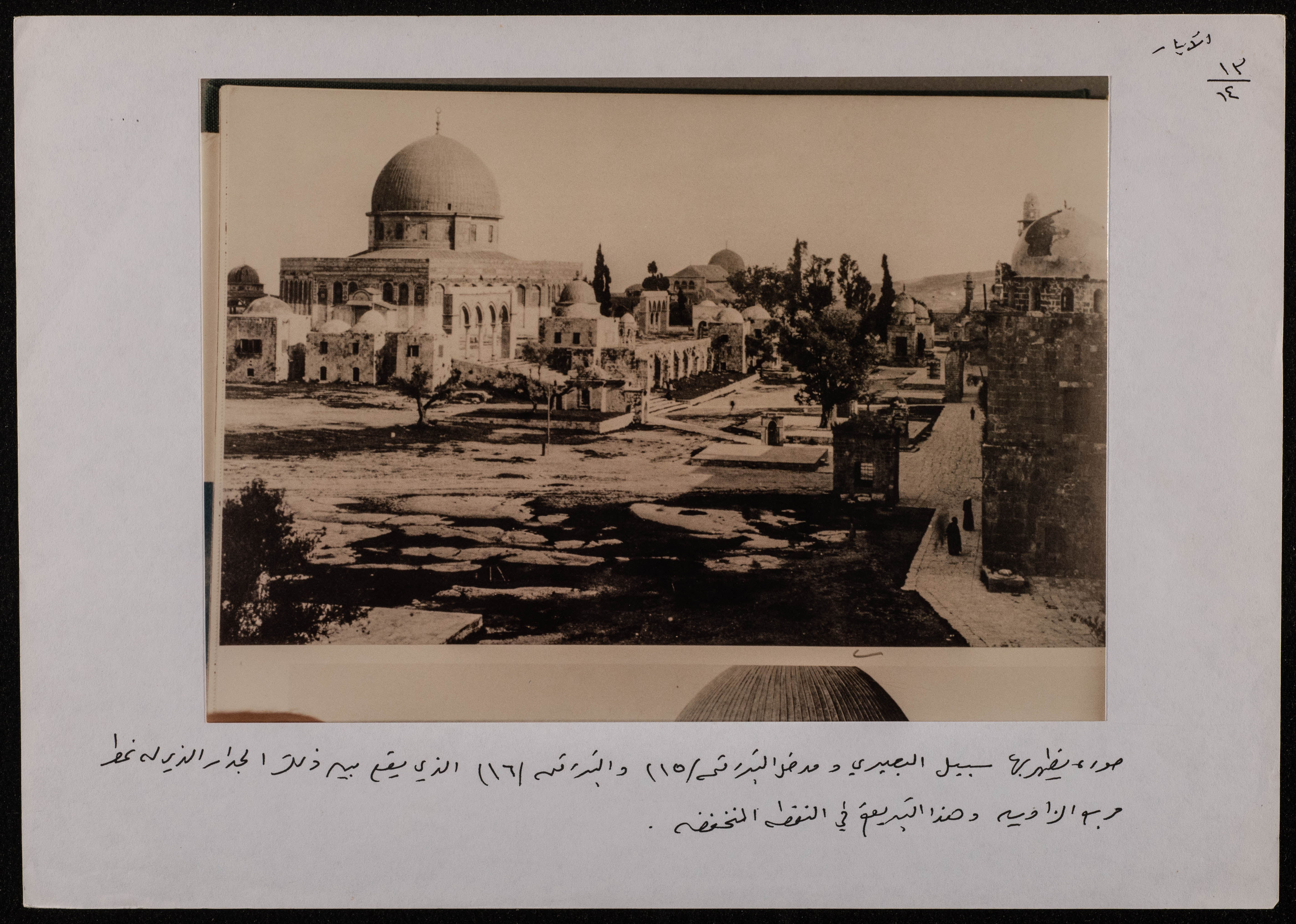
A Photograph of the Dome of the Rock and its Surface, Below Which the Water Wells that Feed the Haram area are Located
This photograph shows the shape of the Dome of the Rock and its surface, under which there are water wells, it is worth noting that all of the Haram areas were wells fed from rainwater and Solomon's Pools in Artas.
Date created
Tags
Topics
TYPE
LOCATION
More details
Format
Color photographs
Source of Description
Jubeh, Baha (Palestinian Museum Registrar), recorded interview with PMDA researcher Samar Ozrail, 24 March 2021, the Palestinian Museum Digital Archive.
Physical status
medium
Help us refine the information, suggest a change in the content of this item
Suggest a Change0294.01.0369
A Photograph of the Dome of the Rock and its Surface, Below Which the Water Wells that Feed the Haram area are Located
This photo may contain violent content