0294.02.0021
The Plan of Position and Demarcation by the Nablus Municipality, 1998
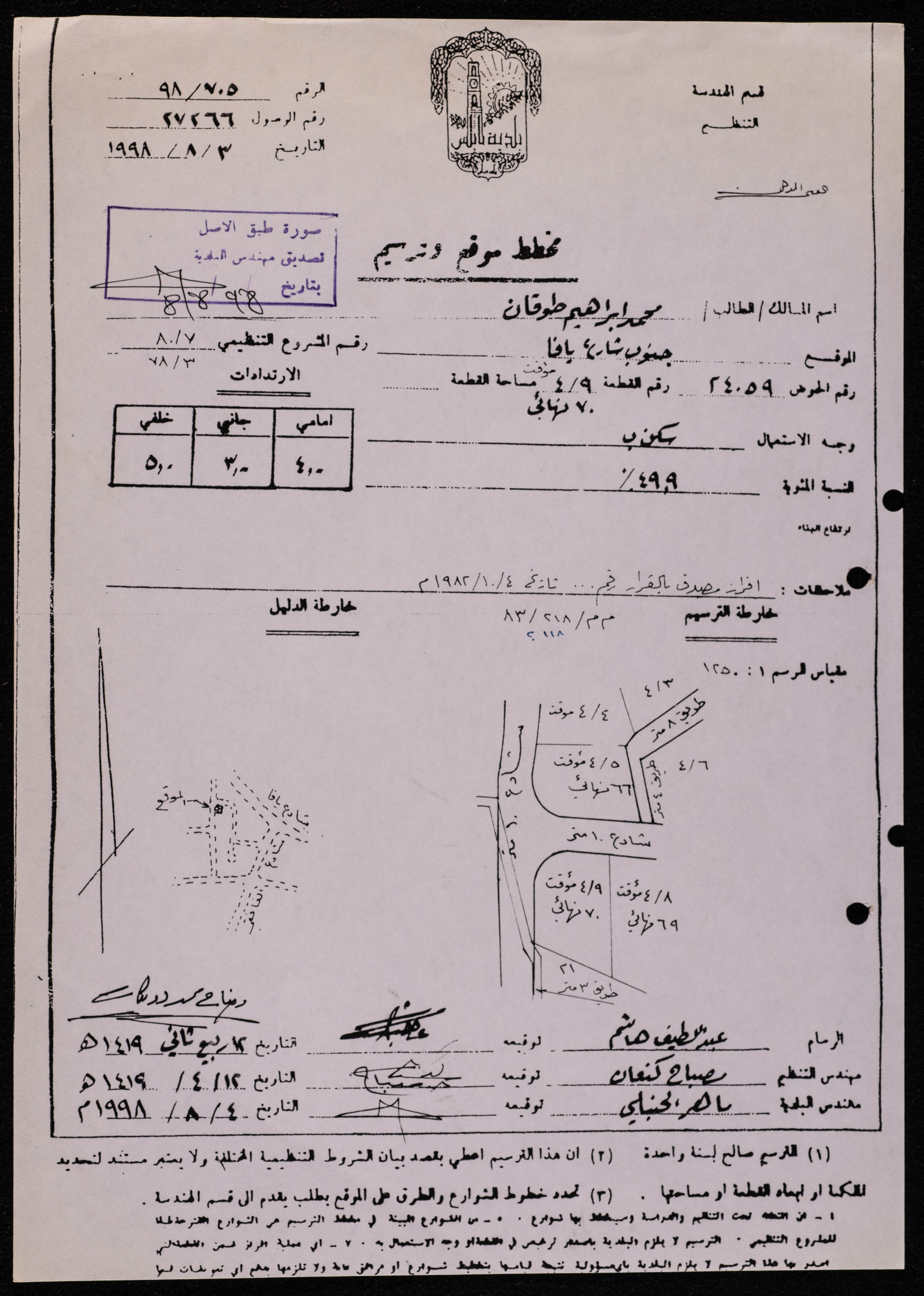
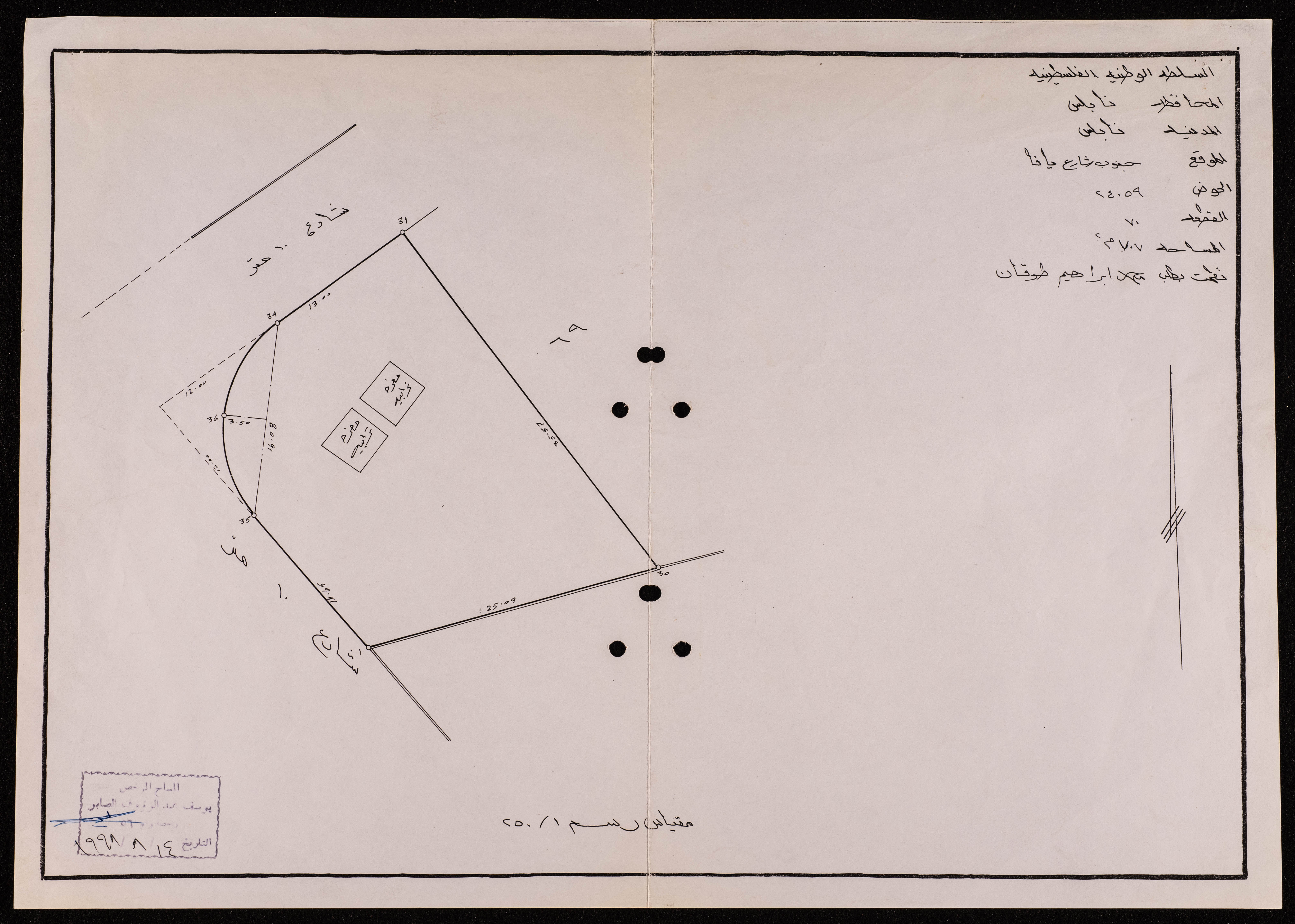
Issued by the Nablus Municipality on 3 August 1998, this archival item documents a plan of position and demarcation of the owner Mohammad Ibrahim Touqan, with the location south of Jaffa street. The document also includes a guide map and a demarcation map, in addition to the authenticating seal of the Municipality's engineer.
Date created
Tags
Topics
TYPE
LOCATION
More details
Format
Records (Documents)
Physical status
good
Help us refine the information, suggest a change in the content of this item
Suggest a Change0294.02.0021
The Plan of Position and Demarcation by the Nablus Municipality, 1998
This photo may contain violent content